Situated between Hilton Head Island, South Carolina, and the mouth of the Savannah River, Daufuskie Island lies along one of the busiest maritime corridors on the southeastern U.S. coast.

A Gateway to the Port of Savannah
The primary reason for heavy maritime traffic around Daufuskie Island is its proximity to the Savannah River and the deepwater channel leading to the Port of Savannah. Large container ships approach the coast from the Atlantic and travel through the harbor entrance. Then, they head upriver toward Savannah’s terminals. The navigation channel includes an 11.5-mile entrance channel and a 21-mile inner harbor channel, maintained by regular dredging to accommodate modern cargo vessels.
This route is essential for global trade. The Port of Savannah ranks among the busiest container ports in the United States. It handles massive volumes of imports and exports each year. As a result, ships carrying everything from automobiles and electronics to agricultural goods regularly pass offshore from the Lowcountry islands.
Calibogue Sound and Local Navigation
Just north of Daufuskie Island lies Calibogue Sound, the broad tidal inlet separating Daufuskie from Hilton Head Island. This sound connects the Intracoastal Waterway, local marinas, and recreational boating routes to the ocean. It serves mostly smaller vessels. But it also acts as an approach area for ships navigating toward the Savannah River entrance.
The waters around the sound are complex and dynamic. Shoals shift regularly, creating winding channels that must be carefully navigated using buoys and range markers. Mariners entering the sound pass between Daufuskie and Hilton Head. They then traverse along marinas, creeks, and anchorages along the South Carolina coast.
Historic Navigation Aids
Because of the importance of these waterways, navigation aids were installed in the late nineteenth century to guide ships safely through the region. On the northern end of Daufuskie Island, the Haig Point Range Lights, built in 1873, helped vessels line up with the shipping channel approaching the Savannah River. A decade later, the Bloody Point Range Lights were added to guide ships approaching the harbor entrance.
These lights were critical during a period when maritime commerce was expanding after the Civil War. Steamships and cargo vessels needed reliable visual markers to avoid shoals and shifting sandbars along the coast.
Offshore Anchorages and Waiting Ships
Another familiar sight off the coast near Daufuskie and Hilton Head is a line of large cargo ships waiting at anchor. These vessels often pause offshore until a berth opens at the Port of Savannah or until harbor pilots are available to guide them up the river. In busy periods, dozens of ships may wait in the waters near the harbor entrance before entering port.
This staging area typically lies beyond the immediate shoreline. On clear days, it highlights the global shipping routes that pass by the Lowcountry’s barrier islands.
A Working Waterway in a Scenic Setting
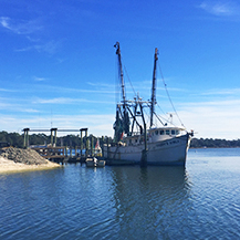
The waters surrounding Daufuskie Island are part of a highly active maritime network. Commercial shipping lanes, recreational boating routes, ferry traffic, and fishing vessels all share the same tidal estuaries and coastal passages.
Related Posts
-
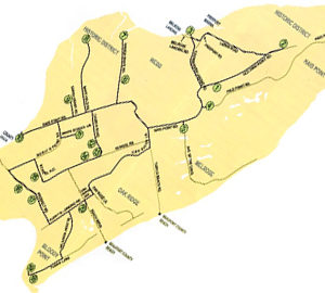
Daufuskie Island Map
Below is a map of the Island. 1. Mt. Carmel Baptist Church No. 2 (Billie…
-
DAUFUSKIE ISLAND HISTORICAL FOUNDATION
WALK THROUGH THE HISTORY OF DAUFUSKIE ISLAND at the DAUFUSKIE ISLAND HISTORICAL FOUNDATION Everything You…
-
Why Daufuskie Island Still Feels Like Old Coastal Carolina
Step onto Daufuskie Island and it’s immediately clear—you haven’t just crossed a stretch of water,…